 |
|
|
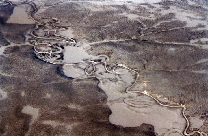
A Photo of a Meandering River in Northern Siberia, Russia.
North Pole Expedition 2002.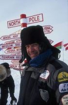
|
A Photo of a Meandering River in Northern Siberia, Russia.North Pole Expedition 2002. |
||
|
|
This is a great photo view of a meandering river in Northern Siberia showing many oxbow lakes. |
| North Pole 2002 Aerial Photos page 2 |
| Jet Fighters | Motorcycles | Ships | Spacecraft | Tanks | Acoustic Guitars for Sale |
 |
|
|
Home Page |
|
| A meandering river in Russian Northern Siberian
somewhere between the town of Noril'sk to Khatanga. Note the river basin.
The only real way to map this river is to map the extents of the river
basin and not the river itself. Mapping the actual river would be fruitless because its path
changes, probably, yearly. Look at the oxbow lakes buried beneath
the snow. You can see that there have been recent river changes, and
by looking deeper into the snow, there is evidence of river beds, possibly
from the previous two years.
I was thinking about this frequent change in the course of these rivers and came up with a probable cause as being large chunks of ice causing an Ice Dam, changing the course of the river. As we flew across Siberia, we found that there was only a very short distance from one river to the next. Northern Siberia is one of the wettest places that I have ever seen with more lakes per section than in Minnesota. There is another thing that I have learned about Siberia in Northern Russia. That is that these northerly flowing rivers carry many thousands of logs to the Arctic Ocean. These same logs can also create a jamb themselves or could encourage an ice jamb. Looking at the above photo, you can see that this could be also true. |
|
| ||
|
The background
picture on this page is an actual photo of the
snow on the North
Pole. -- C. Jeff Dyrek, webmaster
Avitop.com Aviation banner exchange - Join now!
![]()
![]()
/North_Pole_2002/Aerial_Photos_2.html|10911"
| . |